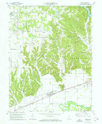
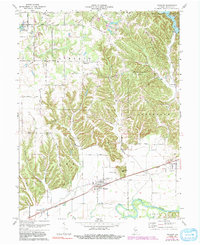
1970 Map of Paragon
USGS Topo · Published 1972About this map
Paragon sits at the base of a series of prominent ridges, where the White River valley transitions into the elevated terrain of the Ashland and Ray townships. The landscape is defined by its drainage patterns, with numerous creeks like Burkhart Creek and Fall Creek cutting through the hills toward the river plain. The Penn Central railroad tracks run parallel to the river, serving as the primary industrial artery for small settlements like Whitaker and Browns Crossing.
Find a feature on this map
49 named features on this map. Tap any name to fly to it.
Don’t see what you’re looking for? This feature index may not catch every label — zoom into the map to look around manually.
Map Details
Editions of this 1970 Paragon Map
5 editions found
Other maps of this area

1942 · Franklin
USGS Topo · 1:125,000

1947 · Gosport
USGS Topo · 1:24,000

1948 · Hindustan
USGS Topo · 1:24,000

1949 · Quincy
USGS Topo · 1:24,000

1950 · Gosport
USGS Topo · 1:24,000

1953 · Indianapolis
USGS Topo · 1:250,000

1955 · Hall
USGS Topo · 1:24,000

1955 · Mooresville West
USGS Topo · 1:24,000

1955 · Martinsville
USGS Topo · 1:24,000

1956 · Indianapolis
USGS Topo · 1:250,000