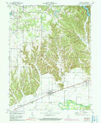
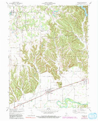
1970 Map of Paragon
USGS Topo · Published 1983About this map
Paragon sits at the nexus of the Conrail rail line and the wide bottomlands of the White River, serving as a focal point for the surrounding rural townships of Ray and Baker. The landscape transitions from the flat, river-carved plains in the south to the dissected uplands of Big Hurricane Hill and Hancock Ridge further north. This shift in topography dictated local settlement patterns, with farms and homesteads clustered along the valley floors and narrow ridges.
Find a feature on this map
47 named features on this map. Tap any name to fly to it.
Don’t see what you’re looking for? This feature index may not catch every label — zoom into the map to look around manually.
Map Details
Editions of this 1970 Paragon Map
5 editions found
Other maps of this area

1942 · Franklin
USGS Topo · 1:125,000

1947 · Gosport
USGS Topo · 1:24,000

1948 · Hindustan
USGS Topo · 1:24,000

1949 · Quincy
USGS Topo · 1:24,000

1950 · Gosport
USGS Topo · 1:24,000

1953 · Indianapolis
USGS Topo · 1:250,000

1955 · Hall
USGS Topo · 1:24,000

1955 · Mooresville West
USGS Topo · 1:24,000

1955 · Martinsville
USGS Topo · 1:24,000

1956 · Indianapolis
USGS Topo · 1:250,000