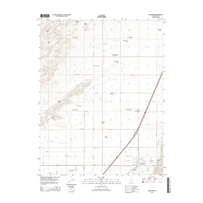
2014 Map of Paragonah
USGS Topo · Published 2014About this map
Paragonah sits at the foot of the Hurricane Cliffs in this modern topographic study of Iron County. The settlement pattern reflects the traditional grid of the Parowan Valley, where irrigation and water management are central to the landscape as seen through the courses of Red Cr and Little Cr. The survey illustrates the transition from the high elevations of Jackrabbit Mtn and the Red Hills down to the agricultural flats around Wheatgrass. Significant local infrastructure is noted, including the Flying Cal-Ute Rancheros Airport and the centrally located Paragonah Cem. The map provides detailed placement for several seasonal water features like Slough Wash and Kane Spring Wash, which drain from the rugged northern heights toward the valley floor, defining the character of places like Chimney Meadow and Slough Bench.
Find a feature on this map
48 named features on this map. Tap any name to fly to it.
Don’t see what you’re looking for? This feature index may not catch every label — zoom into the map to look around manually.
Map Details
Editions of this 2014 Paragonah Map
This is the sole edition of this map. No revisions or reprints were ever made.
Other maps of this area

1885 · Beaver
USGS Topo · 1:250,000

1886 · Kanab
USGS Topo · 1:250,000

1953 · Richfield
USGS Topo · 1:250,000

1953 · Cedar City
USGS Topo · 1:250,000

1958 · Richfield
USGS Topo · 1:250,000

1958 · Cedar City
USGS Topo · 1:250,000

1958 · Minersville
USGS Topo · 1:62,500

1962 · Cedar City
USGS Topo · 1:250,000

1971 · Buckhorn Flat
USGS Topo · 1:24,000

1971 · Paragonah
USGS Topo · 1:24,000