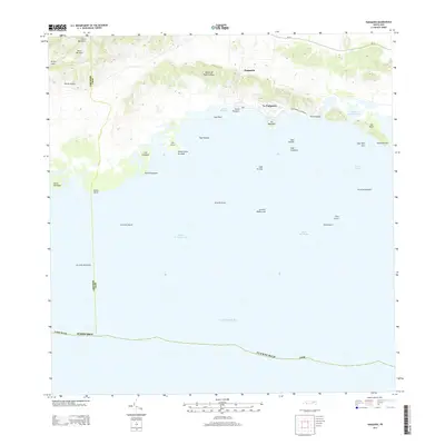
2013 Map of Parguera
USGS Topo · Published 2013About this map
The coastal settlement of La Parguera serves as the focal point of this southwestern Puerto Rican landscape, where the foothills of Sierra Bermeja meet the Caribbean Sea. The terrain is defined by dramatic elevation changes, from the heights of Cerro Mariquita down to the mangrove-lined shore of Bahía Fosforescente. This 2013 survey illustrates a sophisticated maritime environment characterized by a complex network of coral reefs and cays, including Arrecife Coral, Cayo Enrique, and Cayo Caracoles. Inland, the map details established settlements like Parguera and Rancho Cabassa, connected by routes such as PR-116. The mapping of small islands like Isla Magueyes and Isla Guayacán highlights the region's reliance on its coastal geography for both navigation and local identity.
Find a feature on this map
42 named features on this map. Tap any name to fly to it.
Don’t see what you’re looking for? This feature index may not catch every label — zoom into the map to look around manually.
Map Details
Editions of this 2013 Parguera Map
This is the sole edition of this map. No revisions or reprints were ever made.
Other maps of this area

1935 · Puerto Real
USGS Topo · 1:25,000

1937 · San German
USGS Topo · 1:25,000

1937 · Sabana Grande
USGS Topo · 1:25,000

1937 · Puerto Real
USGS Topo · 1:25,000

1938 · Guanica
USGS Topo · 1:30,000

1938 · Parguera
USGS Topo · 1:30,000

1938 · Cabo Rojo
USGS Topo · 1:30,000

1941 · San German
USGS Topo · 1:30,000

1941 · Puerto Real
USGS Topo · 1:30,000

1941 · Sabana Grande
USGS Topo · 1:30,000