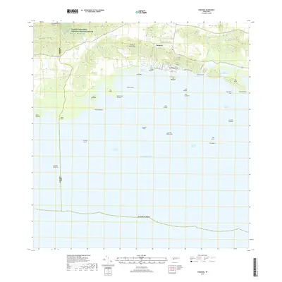
2018 Map of Parguera
USGS Topo · Published 2018About this map
The coastal village of La Parguera and the adjacent Parguera settlement serve as the focal point for this 2018 survey of the southwest coast of the Island of Puerto Rico. This area is defined by a complex marine environment where the Caribbean Sea meets a network of reefs and mangrove-fringed islands, including the bioluminescent waters of Bahia Fosforescente and the research-rich Isla Magueyes. Inland, the landscape rises sharply into the Sierra Bermeja, home to Cerro Mariquita, the highest point in the region. The map captures the interface between the agricultural Valle de Lajas and protected coastal lands, specifically the southern portion of the Laguna Cartagena National Wildlife Refuge. Detailed local infrastructure like Ave Los Pescadores and Villa Pascuales reveals the growth of this maritime community, while named reefs like Arrecife Coral and Arrecife Media Luna highlight the intricate underwater topography essential to local navigation and ecology.
Find a feature on this map
46 named features on this map. Tap any name to fly to it.
Don’t see what you’re looking for? This feature index may not catch every label — zoom into the map to look around manually.
Map Details
Editions of this 2018 Parguera Map
This is the sole edition of this map. No revisions or reprints were ever made.
Other maps of this area

1935 · Puerto Real
USGS Topo · 1:25,000

1937 · San German
USGS Topo · 1:25,000

1937 · Sabana Grande
USGS Topo · 1:25,000

1937 · Puerto Real
USGS Topo · 1:25,000

1938 · Guanica
USGS Topo · 1:30,000

1938 · Parguera
USGS Topo · 1:30,000

1938 · Cabo Rojo
USGS Topo · 1:30,000

1941 · San German
USGS Topo · 1:30,000

1941 · Puerto Real
USGS Topo · 1:30,000

1941 · Sabana Grande
USGS Topo · 1:30,000