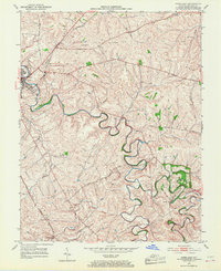
1952 Map of Paris East
USGS Topo · Published 1968About this map
Stoner Creek meanders deeply across this landscape east of Paris, carving intricate loops through the heart of Bourbon County. The terrain is defined by the prominent Cane Ridge, which stretches across the northern portion of the sheet. This mid-century survey illustrates a rural society organized around small waterways and family landmarks, such as Clay Cem and Spears Mill Ch. Transport is anchored by the Louisville and Nashville railroad, which cuts through the northwestern corner near the city and serves the small settlement of Escondida further south. The map provides a detailed look at the drainage network of the Bluegrass region, where numerous tributaries like Strodes Creek, Harrods Creek, and Scott Creek converge, reflecting a landscape that remained largely agricultural and tied to its natural topography during the early 1950s.
Find a feature on this map
16 named features on this map. Tap any name to fly to it.
Don’t see what you’re looking for? This feature index may not catch every label — zoom into the map to look around manually.
Map Details
Editions of this 1952 Paris East Map
4 editions found
Other maps of this area

1927 · Lexington
USGS Topo · 1:48,000

1929 · Cynthiana
USGS Topo · 1:48,000

1929 · Lexington
USGS Topo · 1:62,500

1934 · Cynthiana
USGS Topo · 1:62,500

1952 · Paris East
USGS Topo · 1:24,000

1952 · Clintonville
USGS Topo · 1:24,000

1952 · Austerlitz
USGS Topo · 1:24,000

1952 · North Middletown
USGS Topo · 1:24,000
1952 · Sideview
USGS Topo · 1:24,000

1953 · Carlisle
USGS Topo · 1:24,000