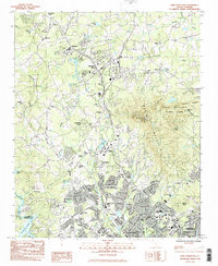
1983 Map of Paris Mountain
USGS Topo · Published 1983About this map
Furman University anchors the center of this 1983 survey, situated between the growing suburban developments of Berea and Travelers Rest. The landscape is defined by the transition from the urban northern edge of Greenville to the prominent rising terrain of Paris Mountain State Park, where the Paris Mtn Radio Mast and multiple radio towers overlook the Piedmont region. This era captures the area's mid-century expansion, evidenced by numerous residential subdivisions like Sharon Park and Leawood alongside older rural landmarks such as Ebenezer Ch and St Lukes Ch.
Find a feature on this map
69 named features on this map. Tap any name to fly to it.
Don’t see what you’re looking for? This feature index may not catch every label — zoom into the map to look around manually.
Map Details
Editions of this 1983 Paris Mountain Map
3 editions found
Other maps of this area

1888 · Pickens
USGS Topo · 1:125,000

1894 · Pickens
USGS Topo · 1:125,000

1905 · Pisgah
USGS Topo · 1:125,000

1906 · Pisgah
USGS Topo · 1:125,000

1907 · Saluda
USGS Topo · 1:125,000

1935 · Greenville
USGS Topo · 1:48,000

1938 · Greenville
USGS Topo · 1:62,500

1954 · Greenville
USGS Topo · 1:250,000

1955 · Knoxville
USGS Topo · 1:250,000

1957 · Greenville
USGS Topo · 1:24,000