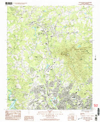
1983 Map of Paris Mountain
USGS Topo · Published 1983About this map
Furman University sits at the heart of this landscape, surrounded by the suburban and rural developments of the early 1980s. The map captures a transitional era for Greenville as residential growth reaches toward Travelers Rest and the base of Paris Mountain. To the east, Paris Mountain State Park encompasses Brissy Ridge and Buckhorn Creek, while several radio and television installations like the Paris Mtn Radio Mast crown the peaks. This survey preserves a dense network of local community markers, including Duncan Chapel Sch, Grandview Cem, and St Lukes Ch, alongside the industrial and infrastructure corridors of the Northwestern RR and the Seaboard Coast Line. Water defines the boundaries, with the Enoree River flowing to the north and the Saluda River forming the western edge of Greenville Co.
Find a feature on this map
67 named features on this map. Tap any name to fly to it.
Don’t see what you’re looking for? This feature index may not catch every label — zoom into the map to look around manually.
Map Details
Editions of this 1983 Paris Mountain Map
3 editions found
Other maps of this area

1888 · Pickens
USGS Topo · 1:125,000

1894 · Pickens
USGS Topo · 1:125,000

1905 · Pisgah
USGS Topo · 1:125,000

1906 · Pisgah
USGS Topo · 1:125,000

1907 · Saluda
USGS Topo · 1:125,000

1935 · Greenville
USGS Topo · 1:48,000

1938 · Greenville
USGS Topo · 1:62,500

1954 · Greenville
USGS Topo · 1:250,000

1955 · Knoxville
USGS Topo · 1:250,000

1957 · Greenville
USGS Topo · 1:24,000