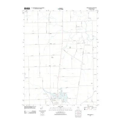
2012 Map of Paris North
USGS Topo · Published 2012About this map
Twin Lakes serves as the focal point for this section of eastern Illinois, providing a detailed view of the suburban and rural transition north of Paris. The landscape is defined by its agricultural grid, intersected by natural watercourses such as S Fork Brouilletts Cr, Snake Cr, and Sugar Cr. Small crossroads communities and rail-era sidings like Horace, Wetzel, and Harris are distributed across the prairie, reflecting the historical settlement patterns of the region. The map provides significant value for genealogists, as it documents numerous rural burial grounds including Scott Cem, Conkey Cem, and Sixteen Cem. To the south, residential development around Saint Marys Cem and Paris Memorial Gardens shows the expansion of the county seat, while Edgar County Airport marks the modern transportation infrastructure of the 21st century.
Find a feature on this map
45 named features on this map. Tap any name to fly to it.
Don’t see what you’re looking for? This feature index may not catch every label — zoom into the map to look around manually.
Map Details
Editions of this 2012 Paris North Map
This is the sole edition of this map. No revisions or reprints were ever made.
Other maps of this area

1946 · Kansas
USGS Topo · 1:62,500

1947 · Ridge Farm
USGS Topo · 1:62,500

1947 · Paris
USGS Topo · 1:62,500

1949 · Kansas
USGS Topo · 1:62,500

1949 · Paris
USGS Topo · 1:62,500

1950 · Sandford
USGS Topo · 1:24,000

1951 · Saint Bernice
USGS Topo · 1:24,000

1953 · Indianapolis
USGS Topo · 1:250,000

1955 · Scottland
USGS Topo · 1:24,000

1956 · Indianapolis
USGS Topo · 1:250,000