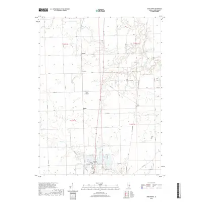
2018 Map of Paris North
USGS Topo · Published 2018About this map
The northern edge of Paris, Illinois, anchors the southern portion of this landscape, where the residential grid meets the expansive agricultural fields of Edgar County. The area is defined by a series of small rural communities such as Horace, Wetzel, and Harris, all interconnected by a rectilinear road system that reflects the region's long-established survey patterns. Significant local landmarks include the Twin Lakes at the edge of the city and the Edgar County Airport to the north. Genealogists and historians will find interest in the numerous rural burial sites scattered across the township, such as Sixteen Cem, Franklin Cem, and Scott Cem. The terrain is drained by several meandering watercourses, including Sugar Cr and Snake Cr, which break the flat prairie topography and provide natural variation near the prominent Wolf Mound.
Find a feature on this map
56 named features on this map. Tap any name to fly to it.
Don’t see what you’re looking for? This feature index may not catch every label — zoom into the map to look around manually.
Map Details
Editions of this 2018 Paris North Map
This is the sole edition of this map. No revisions or reprints were ever made.
Other maps of this area

1946 · Kansas
USGS Topo · 1:62,500

1947 · Ridge Farm
USGS Topo · 1:62,500

1947 · Paris
USGS Topo · 1:62,500

1949 · Kansas
USGS Topo · 1:62,500

1949 · Paris
USGS Topo · 1:62,500

1950 · Sandford
USGS Topo · 1:24,000

1951 · Saint Bernice
USGS Topo · 1:24,000

1953 · Indianapolis
USGS Topo · 1:250,000

1955 · Scottland
USGS Topo · 1:24,000

1956 · Indianapolis
USGS Topo · 1:250,000