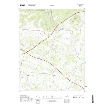
2019 Map of Park City
USGS Topo · Published 2019About this map
Mammoth Cave National Park borders the northern reaches of this landscape, where the southern boundary of the park meets the rolling karst topography of The Knobs. The area is defined by its unusual subterranean drainage patterns, evidenced by numerous named intermittent streams such as Little Sinking Cr, Sinking Br, and Sinking Cr that disappear into the limestone floor.
Find a feature on this map
84 named features on this map. Tap any name to fly to it.
Don’t see what you’re looking for? This feature index may not catch every label — zoom into the map to look around manually.
Map Details
Editions of this 2019 Park City Map
This is the sole edition of this map. No revisions or reprints were ever made.
Other maps of this area

1922 · Mammoth Cave
USGS Topo · 1:62,500

1923 · Mammoth Cave
USGS Topo · 1:62,500

1926 · Scottsville
USGS Topo · 1:62,500

1935 · Horse Cave
USGS Topo · 1:48,000

1938 · Horse Cave
USGS Topo · 1:62,500

1953 · Glasgow South
USGS Topo · 1:24,000

1954 · Evansville
USGS Topo · 1:250,000

1954 · Horse Cave
USGS Topo · 1:24,000
1954 · Rhoda
USGS Topo · 1:24,000
1954 · Park City
USGS Topo · 1:24,000