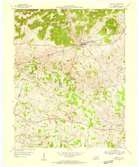
1954 Map of Park City
USGS Topo · Published 1955About this map
Mammoth Cave National Park anchors the northwestern corner of this mid-century survey, where the rugged terrain of The Knobs meets the rolling agricultural lands of Barren, Edmonson, and Warren counties. The landscape is defined by its complex karst topography, evident in the numerous sinkholes and the winding courses of Little Sinking Creek and Sinking Creek. The primary hub is Park City, a vital junction for the Louisville and Nashville railroad and the historic Dixie Highway.
Find a feature on this map
41 named features on this map. Tap any name to fly to it.
Don’t see what you’re looking for? This feature index may not catch every label — zoom into the map to look around manually.
Map Details
Editions of this 1954 Park City Map
2 editions found
Other maps of this area

1922 · Mammoth Cave
USGS Topo · 1:62,500

1923 · Mammoth Cave
USGS Topo · 1:62,500

1926 · Scottsville
USGS Topo · 1:62,500

1935 · Horse Cave
USGS Topo · 1:48,000

1938 · Horse Cave
USGS Topo · 1:62,500

1953 · Glasgow South
USGS Topo · 1:24,000

1954 · Evansville
USGS Topo · 1:250,000

1954 · Horse Cave
USGS Topo · 1:24,000
1954 · Rhoda
USGS Topo · 1:24,000
1954 · Meador
USGS Topo · 1:24,000