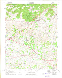
1973 Map of Park City
USGS Topo · Published 1974About this map
Subterranean geology and rural crossroads define this 1973 survey of south-central Kentucky where Barren, Edmonson, and Warren counties meet. The karst landscape is heavily marked by prominent features such as Diamond Caverns, Short Cave, and the intriguing Jessie James Cave, while the northern boundary touches the edge of Mammoth Cave National Park. The local economy and transport are anchored by the Louisville and Nashville railroad corridor, which passes through Park City.
Find a feature on this map
40 named features on this map. Tap any name to fly to it.
Don’t see what you’re looking for? This feature index may not catch every label — zoom into the map to look around manually.
Map Details
Editions of this 1973 Park City Map
This is the sole edition of this map. No revisions or reprints were ever made.
Other maps of this area

1922 · Mammoth Cave
USGS Topo · 1:62,500

1923 · Mammoth Cave
USGS Topo · 1:62,500

1926 · Scottsville
USGS Topo · 1:62,500

1935 · Horse Cave
USGS Topo · 1:48,000

1938 · Horse Cave
USGS Topo · 1:62,500

1953 · Glasgow South
USGS Topo · 1:24,000

1954 · Evansville
USGS Topo · 1:250,000

1954 · Horse Cave
USGS Topo · 1:24,000
1954 · Rhoda
USGS Topo · 1:24,000
1954 · Park City
USGS Topo · 1:24,000