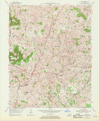
1954 Map of Park
USGS Topo · Published 1968About this map
Alison Knob and the surrounding high ground of the Pennyroyal Plateau dominate this mid-century portrait of south-central Kentucky. The landscape is a network of small agricultural settlements and rural gathering places, including LeGrande, Uno, and Seymour. The map reveals a community structured around its spiritual and educational centers, such as Oak Ridge Sch and several churches like Little Blue Spring Ch and Knob Ch.
Find a feature on this map
40 named features on this map. Tap any name to fly to it.
Don’t see what you’re looking for? This feature index may not catch every label — zoom into the map to look around manually.
Map Details
Editions of this 1954 Park Map
2 editions found
Other maps of this area

1934 · Munfordville
USGS Topo · 1:48,000

1935 · Horse Cave
USGS Topo · 1:48,000

1937 · Munfordville
USGS Topo · 1:62,500

1938 · Horse Cave
USGS Topo · 1:62,500

1953 · Sulphur Well
USGS Topo · 1:24,000

1953 · Hudgins
USGS Topo · 1:24,000

1953 · Munfordville
USGS Topo · 1:24,000

1953 · Center
USGS Topo · 1:24,000
1953 · Canmer
USGS Topo · 1:24,000

1954 · Park
USGS Topo · 1:24,000