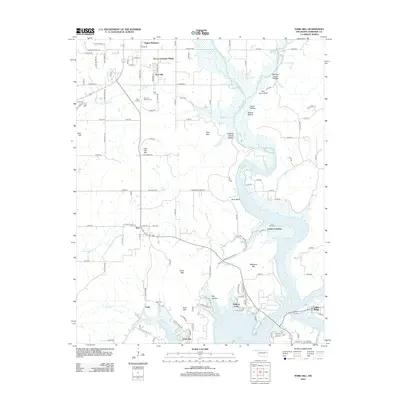
2012 Map of Park Hill
USGS Topo · Published 2012About this map
Park Hill and its neighboring settlements occupy the landscape where the northern reaches of Tenkiller Lake meet the foothills of the Ozarks. This area is characterized by its deep connection to Cherokee heritage, visible through sites like Tsa La Gi Indian Village and the Park Hill Mission Cem. The map reveals a community defined by its proximity to water and terrain, with several hollows such as Ross Hollow and Manes Hollow carving through the higher elevations.
Find a feature on this map
75 named features on this map. Tap any name to fly to it.
Don’t see what you’re looking for? This feature index may not catch every label — zoom into the map to look around manually.
Map Details
Editions of this 2012 Park Hill Map
This is the sole edition of this map. No revisions or reprints were ever made.
Other maps of this area

1898 · Tahlequah
USGS Topo · 1:125,000

1901 · Muscogee
USGS Topo · 1:125,000

1901 · Tahlequah
USGS Topo · 1:125,000

1905 · Muscogee
USGS Topo · 1:125,000

1905 · Tahlequah
USGS Topo · 1:125,000

1946 · Fort Smith
USGS Topo · 1:250,000

1948 · Hulbert
USGS Topo · 1:62,500

1948 · Webbers Falls
USGS Topo · 1:62,500

1950 · Hulbert
USGS Topo · 1:62,500

1950 · Webbers Falls
USGS Topo · 1:62,500