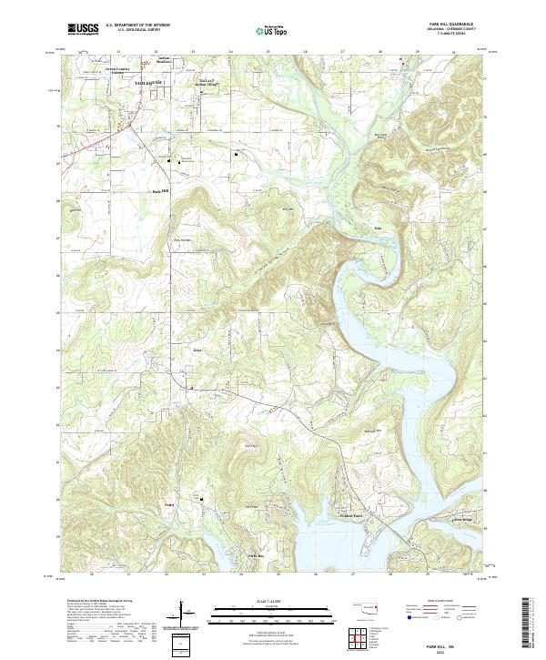
2022 Map of Park Hill
USGS Topo · Published 2022About this map
Tsa La Gi Indian Village stands as a prominent cultural landmark just south of Tahlequah, anchoring a landscape where the Illinois River meets the northern reaches of Tenkiller Ferry Lake. This modern survey reveals a region defined by its narrow hollows and high bluffs, including Boy Scout Bluff and Alum Bluff, which overlook the river's winding path toward Wildcat Point. The settlement patterns here are deeply tied to the terrain, with communities like Park Hill and Pettit situated among numerous historic burial sites such as Worcester Mission Cem and Ross Cem.
Find a feature on this map
128 named features on this map. Tap any name to fly to it.
Don’t see what you’re looking for? This feature index may not catch every label — zoom into the map to look around manually.
Map Details
Editions of this 2022 Park Hill Map
This is the sole edition of this map. No revisions or reprints were ever made.
Other maps of this area

1898 · Tahlequah
USGS Topo · 1:125,000

1901 · Muscogee
USGS Topo · 1:125,000

1901 · Tahlequah
USGS Topo · 1:125,000

1905 · Muscogee
USGS Topo · 1:125,000

1905 · Tahlequah
USGS Topo · 1:125,000

1946 · Fort Smith
USGS Topo · 1:250,000

1948 · Hulbert
USGS Topo · 1:62,500

1948 · Webbers Falls
USGS Topo · 1:62,500

1950 · Hulbert
USGS Topo · 1:62,500

1950 · Webbers Falls
USGS Topo · 1:62,500