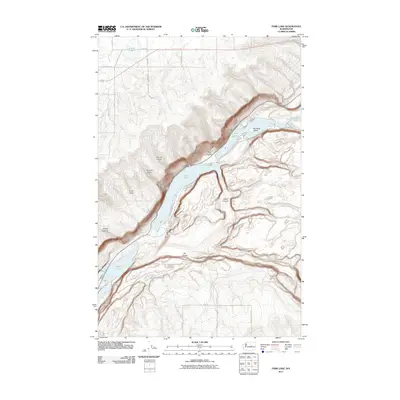
2011 Map of Park Lake
USGS Topo · Published 2011About this map
Park Lake and Blue Lake anchor this 2011 survey of the coulee country in Grant County, where the topography is defined by dramatic basalt walls and recessed basins. The chain of water bodies, including Alkali Lake and Lenore Lake, follows the path of the Grand Coulee, a geological signature of the region's glacial past. This landscape is a labyrinth of erosion, with deep incisions like Jasper Canyon and Deer Canyon cutting into the surrounding plateau.
Find a feature on this map
28 named features on this map. Tap any name to fly to it.
Don’t see what you’re looking for? This feature index may not catch every label — zoom into the map to look around manually.
Map Details
Editions of this 2011 Park Lake Map
This is the sole edition of this map. No revisions or reprints were ever made.
Other maps of this area

1930 · Grand Coulee Sheet 3
USGS Topo · 1:31,680

1953 · Ritzville
USGS Topo · 1:250,000

1956 · Ephrata
USGS Topo · 1:62,500

1956 · Stratford
USGS Topo · 1:24,000

1956 · Soap Lake
USGS Topo · 1:24,000

1959 · Ritzville
USGS Topo · 1:250,000

1965 · Ritzville
USGS Topo · 1:250,000

1965 · Jameson Lake SE
USGS Topo · 1:24,000

1965 · St. Andrews
USGS Topo · 1:24,000

1965 · Jameson Lake East
USGS Topo · 1:24,000