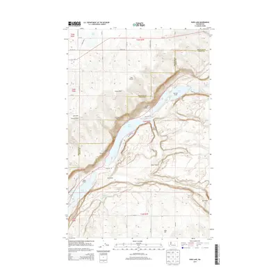
2014 Map of Park Lake
USGS Topo · Published 2014About this map
Park Lake and Blue Lake anchor this 2014 survey of the Coulee corridor along the Douglas and Grant county line. The landscape is defined by the dramatic recessional scars of the Ice Age floods, manifesting as deep basins like Alkali Lake and Lenore Lake at the southern edge. The terrain is marked by numerous draws and canyons including Jasper Canyon, Deer Canyon, and Hybel Canyon, which break the plateau as it drops toward the water. Human presence is largely defined by the path of Wa-17 and a network of county roads like Baseline Rd and Palisades Rd NE that navigate around the water bodies and through Dry Coulee. The presence of Big Rock Island within Park Lake highlights the basaltic features characteristic of this part of Washington. This map captures the intersection of recreation and geology in a region where the massive Coulee walls dictate the layout of every road and boundary.
Find a feature on this map
35 named features on this map. Tap any name to fly to it.
Don’t see what you’re looking for? This feature index may not catch every label — zoom into the map to look around manually.
Map Details
Editions of this 2014 Park Lake Map
This is the sole edition of this map. No revisions or reprints were ever made.
Other maps of this area

1930 · Grand Coulee Sheet 3
USGS Topo · 1:31,680

1953 · Ritzville
USGS Topo · 1:250,000

1956 · Ephrata
USGS Topo · 1:62,500

1956 · Stratford
USGS Topo · 1:24,000

1956 · Soap Lake
USGS Topo · 1:24,000

1959 · Ritzville
USGS Topo · 1:250,000

1965 · Ritzville
USGS Topo · 1:250,000

1965 · Jameson Lake SE
USGS Topo · 1:24,000

1965 · St. Andrews
USGS Topo · 1:24,000

1965 · Jameson Lake East
USGS Topo · 1:24,000