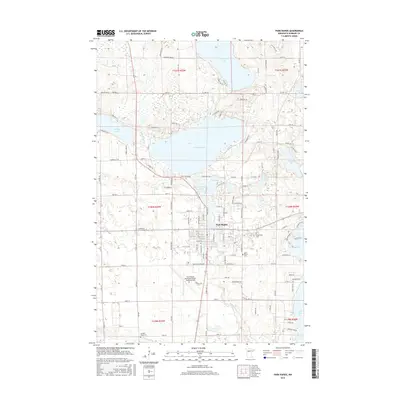
2016 Map of Park Rapids
USGS Topo · Published 2016About this map
Park Rapids serves as the focal point of this Northwoods landscape, where the Fishhook River drains from the expansive Fishhook Lake into the Fish Hook River Reservoir. The town's grid is established north of the Park Rapids Municipal Airport-Konshok Field, while the surrounding countryside is defined by a dense network of glacial lakes including Potato Lake, Portage Lake, and Long Lake. This 2016 survey captures the area's development as a regional hub and recreational destination, showing the modern alignment of the Heartland Trl following former rail corridors.
Find a feature on this map
96 named features on this map. Tap any name to fly to it.
Don’t see what you’re looking for? This feature index may not catch every label — zoom into the map to look around manually.
Map Details
Editions of this 2016 Park Rapids Map
This is the sole edition of this map. No revisions or reprints were ever made.
Other maps of this area

1953 · Brainerd
USGS Topo · 1:250,000

1954 · Bemidji
USGS Topo · 1:250,000

1957 · Brainerd
USGS Topo · 1:250,000

1957 · Bemidji
USGS Topo · 1:250,000

1958 · Bemidji
USGS Topo · 1:250,000

1958 · Brainerd
USGS Topo · 1:250,000

1965 · Brainerd
USGS Topo · 1:250,000

1969 · Park Rapids
USGS Topo · 1:24,000

1969 · Menahga
USGS Topo · 1:24,000

1969 · Park Rapids SW
USGS Topo · 1:24,000