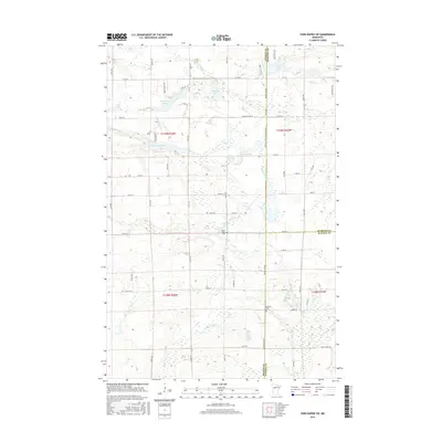
2016 Map of Park Rapids SW
USGS Topo · Published 2016About this map
The Blueberry River and Shell River wind through this pocket of northern Minnesota, defining a landscape marked by numerous glacial lakes and wetlands. This survey provides a look at the rural boundary lands where Becker, Hubbard, and Wadena counties meet. Local history and genealogy are centered around the Green Valley Cem and Alajoki Cem, which serve as quiet markers of the families who settled this lake country. Small water bodies like Knutson Lake, Shipman Lake, and the pair of Little Round Lake and Little Long Lake are connected by a network of township roads and county routes, including Co RD 40 and Knutson Lake Rd. The southern portion of the map is dominated by the course of the Kettle River, illustrating the complex drainage patterns typical of this region.
Find a feature on this map
43 named features on this map. Tap any name to fly to it.
Don’t see what you’re looking for? This feature index may not catch every label — zoom into the map to look around manually.
Map Details
Editions of this 2016 Park Rapids SW Map
This is the sole edition of this map. No revisions or reprints were ever made.
Other maps of this area

1953 · Brainerd
USGS Topo · 1:250,000

1957 · Brainerd
USGS Topo · 1:250,000

1958 · Brainerd
USGS Topo · 1:250,000

1965 · Brainerd
USGS Topo · 1:250,000

1969 · Wolf Lake
USGS Topo · 1:24,000

1969 · Park Rapids
USGS Topo · 1:24,000

1969 · Menahga
USGS Topo · 1:24,000

1969 · Park Rapids SW
USGS Topo · 1:24,000

1969 · Sebeka
USGS Topo · 1:24,000

1969 · Sebeka NW
USGS Topo · 1:24,000