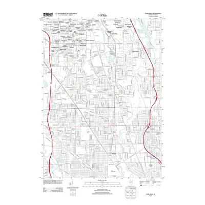
2012 Map of Park Ridge
USGS Topo · Published 2012About this map
Niles and its surrounding suburban enclaves are defined by a complex mosaic of twentieth-century residential development and significant religious and memorial sites. This survey highlights the dense concentration of cemeteries serving the Chicago area, including the sprawling Maryhill Cem, Saint Adelbert Cem, and Town of Maine Cem. The landscape is characterized by a high frequency of distinct subdivisions, such as Stonehedge Glen, The Commons, and Maryland Subdivision, which illustrate the post-war expansion of the Cook County residential corridor.
Find a feature on this map
251 named features on this map. Tap any name to fly to it.
Don’t see what you’re looking for? This feature index may not catch every label — zoom into the map to look around manually.
Map Details
Editions of this 2012 Park Ridge Map
This is the sole edition of this map. No revisions or reprints were ever made.
Other maps of this area

1889 · Chicago
USGS Topo · 1:62,500

1891 · Chicago
USGS Topo · 1:62,500

1891 · Riverside
USGS Topo · 1:62,500

1893 · Riverside
USGS Topo · 1:62,500

1899 · Evanston
USGS Topo · 1:62,500

1900 · Chicago
USGS Topo · 1:62,500

1900 · Riverside
USGS Topo · 1:62,500

1900 · Highwood
USGS Topo · 1:62,500

1901 · Riverside
USGS Topo · 1:62,500

1901 · Chicago
USGS Topo · 1:62,500