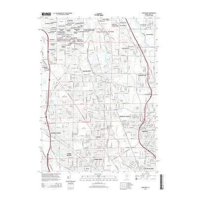
2015 Map of Park Ridge
USGS Topo · Published 2015About this map
The Des Plaines River and the North Branch Chicago River anchor this densely developed landscape northwest of Chicago. The map illustrates the late-stage suburbanization of Cook County, where historical residential enclaves like Summerhill, Stonegate, and Brockdale Manor are woven into the larger municipalities of Glenview, Niles, and Skokie. Significant institutional presence is found at the Hebrew Theological Coll and numerous large religious burial grounds, including Maryhill Cem and Saint Adelbert Cem. These cemeteries, along with preserved natural areas like The Grove and the Skokie Lagoons, provide distinct breaks in the grid of established neighborhoods and modern commercial corridors. The complex water network of the W Fork N Br Chicago River and various man-made lakes, such as Axehead Lake, reflects the extensive drainage and land management required to sustain this metropolitan expansion.
Find a feature on this map
251 named features on this map. Tap any name to fly to it.
Don’t see what you’re looking for? This feature index may not catch every label — zoom into the map to look around manually.
Map Details
Editions of this 2015 Park Ridge Map
This is the sole edition of this map. No revisions or reprints were ever made.
Other maps of this area

1889 · Chicago
USGS Topo · 1:62,500

1891 · Chicago
USGS Topo · 1:62,500

1891 · Riverside
USGS Topo · 1:62,500

1893 · Riverside
USGS Topo · 1:62,500

1899 · Evanston
USGS Topo · 1:62,500

1900 · Chicago
USGS Topo · 1:62,500

1900 · Riverside
USGS Topo · 1:62,500

1900 · Highwood
USGS Topo · 1:62,500

1901 · Riverside
USGS Topo · 1:62,500

1901 · Chicago
USGS Topo · 1:62,500