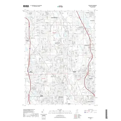
2018 Map of Park Ridge
USGS Topo · Published 2018About this map
The Des Plaines River and the North Branch Chicago River define the geography of this densely settled corridor northwest of Chicago. By 2018, the landscape shows a mature suburban pattern with a notable concentration of memorial sites and institutional landmarks. Large cemetery complexes such as the Maryhill Catholic Cem and Mausoleum and Saint Adalbert Catholic Cem and Mausoleum occupy significant tracts near Niles, while the Skokie Lagoons to the north provide an engineered hydrological landscape. This era reflects the full integration of the Cook County suburbs, where older municipal centers like Glenview, Skokie, and Park Ridge are linked by a complex grid of surface streets and arterial roads. Educational and medical anchors, including the Hebrew Theological College and Glenbrook Hospital, underscore the developed social infrastructure of the region.
Find a feature on this map
95 named features on this map. Tap any name to fly to it.
Don’t see what you’re looking for? This feature index may not catch every label — zoom into the map to look around manually.
Map Details
Editions of this 2018 Park Ridge Map
This is the sole edition of this map. No revisions or reprints were ever made.
Other maps of this area

1889 · Chicago
USGS Topo · 1:62,500

1891 · Chicago
USGS Topo · 1:62,500

1891 · Riverside
USGS Topo · 1:62,500

1893 · Riverside
USGS Topo · 1:62,500

1899 · Evanston
USGS Topo · 1:62,500

1900 · Chicago
USGS Topo · 1:62,500

1900 · Riverside
USGS Topo · 1:62,500

1900 · Highwood
USGS Topo · 1:62,500

1901 · Riverside
USGS Topo · 1:62,500

1901 · Chicago
USGS Topo · 1:62,500