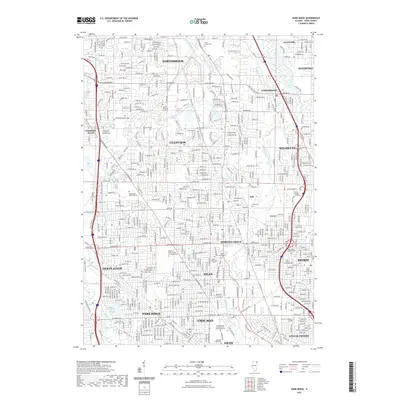
2021 Map of Park Ridge
USGS Topo · Published 2021About this map
Chicago's northern suburbs are defined by a dense network of residential streets and arterial roads in this contemporary landscape. The North Branch Chicago River and its various tributaries, including the W Fork N Branch Chicago River and Skokie River, thread through the sprawling communities of Glenview, Skokie, and Des Plaines. A significant concentration of memorial sites and religious institutions characterizes the area, notably the expansive Saint Adalbert Catholic Cem and Mausoleum and Maryhill Catholic Cem and Mausoleum. The presence of numerous lakes such as Big Bend Lake and Lake Mary Anne indicates the managed water systems within the developed Cook County interior. Major thoroughfares like Milwaukee Ave and W Dempster St connect these established municipalities, illustrating the modern suburban infrastructure and its proximity to the city core.
Find a feature on this map
56 named features on this map. Tap any name to fly to it.
Don’t see what you’re looking for? This feature index may not catch every label — zoom into the map to look around manually.
Map Details
Editions of this 2021 Park Ridge Map
This is the sole edition of this map. No revisions or reprints were ever made.
Other maps of this area

1889 · Chicago
USGS Topo · 1:62,500

1891 · Chicago
USGS Topo · 1:62,500

1891 · Riverside
USGS Topo · 1:62,500

1893 · Riverside
USGS Topo · 1:62,500

1899 · Evanston
USGS Topo · 1:62,500

1900 · Chicago
USGS Topo · 1:62,500

1900 · Riverside
USGS Topo · 1:62,500

1900 · Highwood
USGS Topo · 1:62,500

1901 · Riverside
USGS Topo · 1:62,500

1901 · Chicago
USGS Topo · 1:62,500