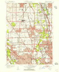
1953 Map of Park Ridge
USGS Topo · Published 1956About this map
The Glenview Naval Air Station dominates the central landscape of this mid-century survey, surrounded by the burgeoning residential corridors of the Cook County North Shore. The map illustrates a period of significant post-war transition as established communities like Glenview and Wilmette expand into former agricultural tracts. Catholic institutional presence is particularly prominent, marked by the sprawling St Marys Mission House and St Anna Infirmary near Techny, alongside numerous parochial schools such as St Pauls Sch.
Find a feature on this map
93 named features on this map. Tap any name to fly to it.
Don’t see what you’re looking for? This feature index may not catch every label — zoom into the map to look around manually.
Map Details
Editions of this 1953 Park Ridge Map
This is the sole edition of this map. No revisions or reprints were ever made.
Other maps of this area

1889 · Chicago
USGS Topo · 1:62,500

1891 · Chicago
USGS Topo · 1:62,500

1891 · Riverside
USGS Topo · 1:62,500

1893 · Riverside
USGS Topo · 1:62,500

1899 · Evanston
USGS Topo · 1:62,500

1900 · Chicago
USGS Topo · 1:62,500

1900 · Riverside
USGS Topo · 1:62,500

1900 · Highwood
USGS Topo · 1:62,500

1901 · Riverside
USGS Topo · 1:62,500

1901 · Chicago
USGS Topo · 1:62,500