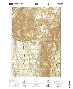
2020 Map of Parkdale
USGS Topo · Published 2020About this map
Parkdale and the surrounding orchard lands of Upper Hood River Valley are defined by a complex network of water management, visible in the intricate paths of the Mount Hood Canal and Highline Lateral. This 2020 survey documents the rural character of northern Oregon, where family history is preserved at the Shelley Family Cem and the solitary Homesteader Grave. The landscape transitions from the developed flats of Dukes Valley and Middle Valley into the protected timberlands of Mount Hood National Forest. Local infrastructure is anchored by the Emil Cr Reservoir and Aubert Reservoir, which support the agriculture of the region. Notable terrain features like Surveyors Ridge and Bald Butte overlook the valley settlements, providing a clear picture of the modern balance between residential life, irrigation-dependent farming, and the natural geography of the Hood River basin.
Find a feature on this map
146 named features on this map. Tap any name to fly to it.
Don’t see what you’re looking for? This feature index may not catch every label — zoom into the map to look around manually.
Map Details
Editions of this 2020 Parkdale Map
This is the sole edition of this map. No revisions or reprints were ever made.
Other maps of this area

1924 · Mount Hood
USGS Topo · 1:125,000

1926 · Hood River
USGS Topo · 1:125,000

1927 · Mount Hood
USGS Topo · 1:125,000

1929 · Hood River
USGS Topo · 1:125,000

1930 · Dufur
USGS Topo · 1:125,000

1934 · Dufur
USGS Topo · 1:125,000

1934 · The Dalles
USGS Topo · 1:125,000

1953 · The Dalles
USGS Topo · 1:250,000

1956 · The Dalles
USGS Topo · 1:250,000

1957 · The Dalles
USGS Topo · 1:250,000