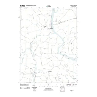
2010 Map of Parker
USGS Topo · Published 2010About this map
The Allegheny River and Clarion River converge in this northern Pennsylvania landscape, carving deep valleys through the plateau. Small industrial and river towns such as Parker, Lawrenceburg, and Parkers Landing cluster along the riverbanks, while the surrounding upland is marked by a dense network of local roads and scattered settlements like Bonus and Queenstown. The terrain is characterized by prominent rises such as Church Hill and Dutch Hill, overlooking the winding waterways and islands including Clarion Island and Black Fox Island.
Find a feature on this map
91 named features on this map. Tap any name to fly to it.
Don’t see what you’re looking for? This feature index may not catch every label — zoom into the map to look around manually.
Map Details
Editions of this 2010 Parker Map
This is the sole edition of this map. No revisions or reprints were ever made.
Other maps of this area

1900 · Kittanning
USGS Topo · 1:62,500

1902 · Kittanning
USGS Topo · 1:62,500

1907 · Foxburg
USGS Topo · 1:62,500

1908 · Foxburg
USGS Topo · 1:62,500

1909 · Butler
USGS Topo · 1:62,500

1910 · Hilliards
USGS Topo · 1:62,500

1911 · Butler
USGS Topo · 1:62,500

1912 · Hilliards
USGS Topo · 1:62,500

1944 · Hilliards
USGS Topo · 1:62,500

1953 · Pittsburgh
USGS Topo · 1:250,000