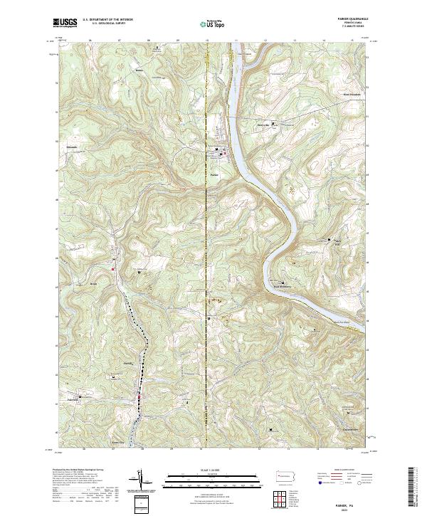
2023 Map of Parker
USGS Topo · Published 2023About this map
The Allegheny River and Clarion River converge in this landscape, shaping the rugged boundaries between Butler, Clarion, and Armstrong counties. The city of Parker sits at this historic river junction, flanked by Columbia Hill and the waters of Thoms Run. The region is defined by a dense network of small communities and crossroads, including Petrolia, Bruin, and Karns City to the southwest, and West Monterey tucked into a sharp bend of the Allegheny.
Find a feature on this map
119 named features on this map. Tap any name to fly to it.
Don’t see what you’re looking for? This feature index may not catch every label — zoom into the map to look around manually.
Map Details
Editions of this 2023 Parker Map
This is the sole edition of this map. No revisions or reprints were ever made.
Other maps of this area

1900 · Kittanning
USGS Topo · 1:62,500

1902 · Kittanning
USGS Topo · 1:62,500

1907 · Foxburg
USGS Topo · 1:62,500

1908 · Foxburg
USGS Topo · 1:62,500

1909 · Butler
USGS Topo · 1:62,500

1910 · Hilliards
USGS Topo · 1:62,500

1911 · Butler
USGS Topo · 1:62,500

1912 · Hilliards
USGS Topo · 1:62,500

1944 · Hilliards
USGS Topo · 1:62,500

1953 · Pittsburgh
USGS Topo · 1:250,000