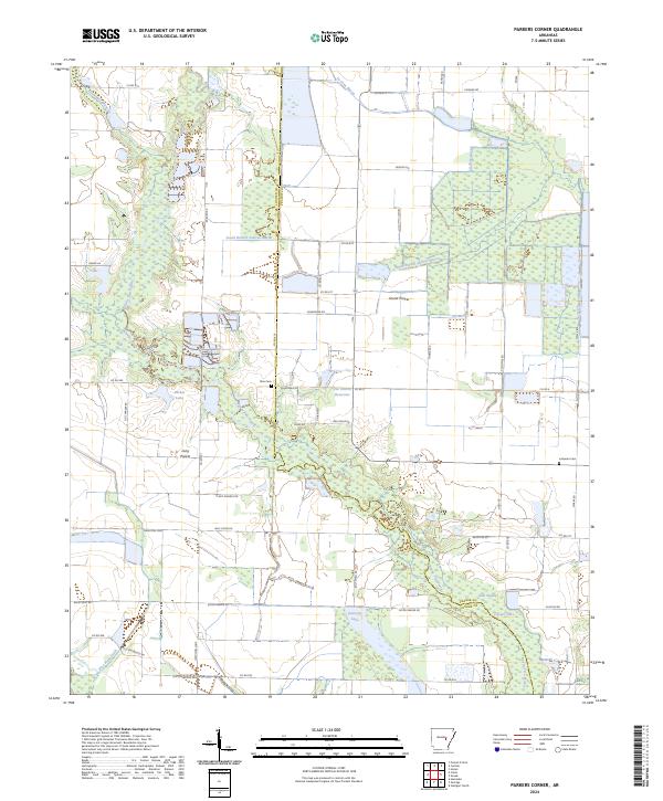
2024 Map of Parkers Corner
USGS Topo · Published 2024About this map
Grand Prairie and Long Prairie dominate this agricultural landscape on the border of Lonoke and Prairie Counties. The terrain is defined by a complex network of waterways, including the winding course of Bayou Two Prairie and South Branch LaGrue Bayou. These drainages are interspersed with various impoundments and natural bodies of water such as Parker Lake, Peterson Lake, and the Joe Uhren Reservoir. Rural life is centered around a grid of local roads named for established families, including Uhren Rd, Marek Rd, and Otis Parker Rd. Local heritage is anchored by sites such as Zion Cem and Lutheran Cem, while the extensive wetland areas like Gum Swamp reflect the low-lying nature of this eastern Arkansas region.
Find a feature on this map
58 named features on this map. Tap any name to fly to it.
Don’t see what you’re looking for? This feature index may not catch every label — zoom into the map to look around manually.
Map Details
Editions of this 2024 Parkers Corner Map
This is the sole edition of this map. No revisions or reprints were ever made.
Other maps of this area

1935 · Hazen
USGS Topo · 1:62,500

1937 · Stuttgart
USGS Topo · 1:62,500

1937 · England
USGS Topo · 1:48,000

1939 · Stuttgart
USGS Topo · 1:62,500

1940 · Lonoke
USGS Topo · 1:62,500

1941 · Hazen
USGS Topo · 1:62,500

1943 · England
USGS Topo · 1:62,500

1948 · Helena
USGS Topo · 1:250,000

1949 · Lonoke
USGS Topo · 1:62,500

1950 · Helena
USGS Topo · 1:250,000