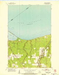
1954 Map of Parkland
USGS Topo · Published 1955About this map
Wisconsin Point stretches across the shoreline of Lake Superior in this mid-1950s survey of Douglas County, shielding the waters of Allouez Bay from the open lake. The landscape is defined by the logistical transition from the industrial port of Superior to the rural townships of Parkland and Amnicon. Rail infrastructure is prominent, featuring the routes of the Northern Pacific and the Chicago and Northwestern railroads as they converge near the settlement of Parkland.
Find a feature on this map
19 named features on this map. Tap any name to fly to it.
Don’t see what you’re looking for? This feature index may not catch every label — zoom into the map to look around manually.
Map Details
Editions of this 1954 Parkland Map
3 editions found
Other maps of this area

1895 · Duluth
USGS Topo · 1:62,500

1915 · Superior
USGS Topo · 1:48,000

1917 · Superior
USGS Topo · 1:62,500

1949 · Poplar
USGS Topo · 1:48,000

1953 · Lakewood
USGS Topo · 1:24,000

1953 · Duluth
USGS Topo · 1:24,000

1953 · Duluth
USGS Topo · 1:62,500

1953 · Ashland
USGS Topo · 1:250,000

1953 · Duluth
USGS Topo · 1:250,000

1954 · Sunnyside
USGS Topo · 1:24,000