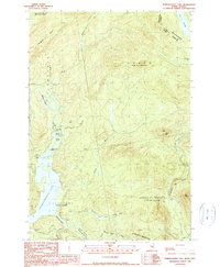
1990 Map of Parmachenee Lake
USGS Topo · Published 1990About this map
The Parmachenee Lake basin and its surrounding timberlands are defined by the sharp international boundary of the United States-Canada border. This wilderness area, surveyed toward the end of the 20th century, showcases the complex drainage networks of the Magalloway River and its numerous tributaries like Moose Brook and Lynx Brook. The landscape is partitioned into unorganized townships including Lynchtown and Oxbow, where logging activity is evidenced by several Gravel Pits tucked into the hillsides. Higher elevations are dominated by peaks such as Cupsuptic Mountain and Bottle Mtn, while water features like Little Boy Falls and Indian Cove mark the rugged transition from river to lake. Small bodies of water, including Otter Pond and Saturday Pond, are scattered throughout the dense drainages, illustrating the hydrologic character of the Oxford County backcountry.
Find a feature on this map
30 named features on this map. Tap any name to fly to it.
Don’t see what you’re looking for? This feature index may not catch every label — zoom into the map to look around manually.
Map Details
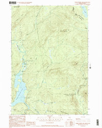
Editions of this 1990 Parmachenee Lake Map
2 editions found
Other maps of this area

1927 · Moose Bog
USGS Topo · 1:48,000

1927 · Second Lake
USGS Topo · 1:62,500

1931 · Cupsuptic
USGS Topo · 1:48,000

1931 · Moose Bog
USGS Topo · 1:62,500

1932 · Second Lake
USGS Topo · 1:62,500

1932 · Arnold Pond
USGS Topo · 1:48,000

1934 · Cupsuptic
USGS Topo · 1:62,500

1935 · Cupsuptic
USGS Topo · 1:62,500

1935 · Arnold Pond
USGS Topo · 1:62,500

1949 · Jackman
USGS Topo · 1:250,000