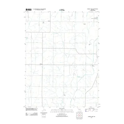
2011 Map of Parnell West
USGS Topo · Published 2011About this map
The Platte River snakes through the eastern reaches of this Missouri landscape, anchoring a network of tributaries that define the local geography. Small settlements including Gaynor, Orrsburg, and Bunker Hill are positioned along a structured grid of county roads, illustrating the enduring agricultural layout of Nodaway County in the early 21st century. This survey documents a transition from purely natural watercourses to managed resources, evidenced by the Platte River Tributaries Watershed Dam Number 5-B and private impoundments like Schmitz Brothers Lake.
Find a feature on this map
36 named features on this map. Tap any name to fly to it.
Don’t see what you’re looking for? This feature index may not catch every label — zoom into the map to look around manually.
Map Details
Editions of this 2011 Parnell West Map
This is the sole edition of this map. No revisions or reprints were ever made.
Other maps of this area

1940 · Bedford
USGS Topo · 1:62,500

1940 · New Market
USGS Topo · 1:62,500

1940 · Parnell
USGS Topo · 1:62,500

1943 · Bedford
USGS Topo · 1:62,500

1943 · Parnell
USGS Topo · 1:62,500

1943 · Maryville
USGS Topo · 1:62,500

1943 · New Market
USGS Topo · 1:62,500

1955 · Nebraska City
USGS Topo · 1:250,000

1957 · Nebraska City
USGS Topo · 1:250,000

1958 · Nebraska City
USGS Topo · 1:250,000