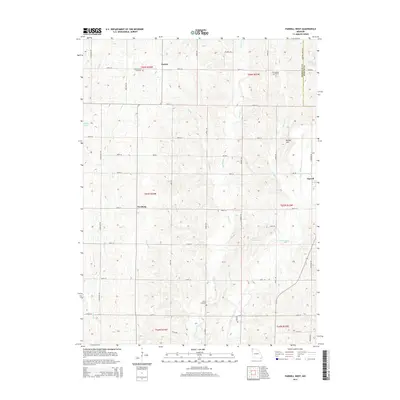
2014 Map of Parnell West
USGS Topo · Published 2014About this map
The Platte River meanders through this portion of Nodaway County, defining a landscape of agricultural drainage and small rural crossroads. The settlement of Gaynor sits in the north near the Long Branch Cemetery, while Orrsburg occupies a central position along the section lines. This 2014 survey documents a modern rural infrastructure defined by a grid of numbered roads like 200th St and Navy Rd, punctuated by family-named landmarks and water bodies. Genealogy researchers will find several well-preserved burial grounds including Wilcox Cemetery and McLaughlin Cemetery. To the east, the village of Parnell is shown at the edge of the quadrangle near the Nodaway-Worth Rd, while local topography is marked by notable rises such as Bunker Hill. The area's water management is evidenced by Wilson Lake and the Number 30 Dam on the upper reaches of the river system.
Find a feature on this map
81 named features on this map. Tap any name to fly to it.
Don’t see what you’re looking for? This feature index may not catch every label — zoom into the map to look around manually.
Map Details
Editions of this 2014 Parnell West Map
This is the sole edition of this map. No revisions or reprints were ever made.
Other maps of this area

1940 · Bedford
USGS Topo · 1:62,500

1940 · New Market
USGS Topo · 1:62,500

1940 · Parnell
USGS Topo · 1:62,500

1943 · Bedford
USGS Topo · 1:62,500

1943 · Parnell
USGS Topo · 1:62,500

1943 · Maryville
USGS Topo · 1:62,500

1943 · New Market
USGS Topo · 1:62,500

1955 · Nebraska City
USGS Topo · 1:250,000

1957 · Nebraska City
USGS Topo · 1:250,000

1958 · Nebraska City
USGS Topo · 1:250,000