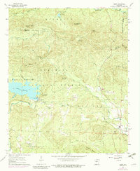
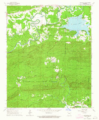
1963 Map of Paron
USGS Topo · Published 1983About this map
Lake Winona dominates the western landscape of this mid-century survey, serving as a significant reservoir managed with a Water Intake, Powerhouse, and a notable Aqueduct system running through the Holland district. The area is characterized by the complex drainage of the North Fork Saline River and Alum Fork Saline River, which carve through the dense terrain of the Ouachita National Forest. Smaller settlements and community centers like Paron and Reform provide focal points for local history, supported by several country churches including Buffalo Ch, Walnut Bottom Ch, and Hester Chapel. The mapping includes revisions from the mid-1970s, showing the evolving infrastructure and land use within Jefferson and surrounding townships. Distinctive summits such as Chinquapin Mountain and Nancy Mountain define the northern ridges near Lake Sylvia.
Find a feature on this map
44 named features on this map. Tap any name to fly to it.
Don’t see what you’re looking for? This feature index may not catch every label — zoom into the map to look around manually.
Map Details
Editions of this 1963 Paron Map
5 editions found

Other maps of this area

1890 · Benton
USGS Topo · 1:125,000

1894 · Benton
USGS Topo · 1:125,000

1938 · Benton
USGS Topo · 1:48,000

1944 · Benton
USGS Topo · 1:62,500

1955 · Little Rock
USGS Topo · 1:250,000

1956 · Little Rock
USGS Topo · 1:250,000

1960 · Little Rock
USGS Topo · 1:250,000

1963 · Paron SW
USGS Topo · 1:24,000
1963 · Thornburg
USGS Topo · 1:24,000

1963 · Fourche SW
USGS Topo · 1:24,000