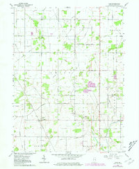
1962 Map of Parr
USGS Topo · Published 1981About this map
The Iroquois River meanders across this rural Jasper County landscape, defined by an intricate network of drainage channels such as Jungles Ditch and Davis Ditch. This 1962 survey reveals a classic Midwestern agricultural pattern where small settlements like Parr and Virgie serve as local hubs for the surrounding townships of Union, Walker, and Barkley.
Find a feature on this map
34 named features on this map. Tap any name to fly to it.
Don’t see what you’re looking for? This feature index may not catch every label — zoom into the map to look around manually.
Map Details
Editions of this 1962 Parr Map
2 editions found

Other maps of this area

1953 · Chicago
USGS Topo · 1:250,000

1953 · Danville
USGS Topo · 1:250,000

1955 · Danville
USGS Topo · 1:250,000

1956 · Danville
USGS Topo · 1:250,000

1957 · Chicago
USGS Topo · 1:250,000

1957 · Wheatfield
USGS Topo · 1:24,000

1957 · DeMotte
USGS Topo · 1:24,000

1959 · Shelby
USGS Topo · 1:24,000

1961 · Mount Ayr
USGS Topo · 1:24,000

1962 · Gifford
USGS Topo · 1:24,000