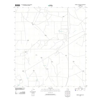
2010 Map of Parrilla Creek SW
USGS Topo · Published 2010About this map
Solo Ranch and a dense network of private ranch roads characterize this section of Duval County in the early 21st century. The landscape is defined by the vital infrastructure of water management, visible through numerous windmills and tanks distributed across the terrain. Notable features include Javalina Windmill, Callejon Windmill, and Artesian Pen Windmill, which reflect the region's deep reliance on groundwater for ranching operations.
Find a feature on this map
25 named features on this map. Tap any name to fly to it.
Don’t see what you’re looking for? This feature index may not catch every label — zoom into the map to look around manually.
Map Details
Editions of this 2010 Parrilla Creek SW Map
This is the sole edition of this map. No revisions or reprints were ever made.
Other maps of this area

1939 · Bruni
USGS Topo · 1:62,500

1956 · Laredo
USGS Topo · 1:250,000

1967 · Parrilla Creek SE
USGS Topo · 1:24,000

1967 · Realitos
USGS Topo · 1:24,000

1967 · Hebbronville NW
USGS Topo · 1:24,000

1968 · Parrilla Creek SW
USGS Topo · 1:24,000

1968 · Mills Bennett
USGS Topo · 1:24,000

1968 · Parrilla Creek NW
USGS Topo · 1:24,000

1968 · Parrilla Creek NE
USGS Topo · 1:24,000

1968 · San Pablo
USGS Topo · 1:24,000