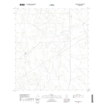
2019 Map of Parrilla Creek SW
USGS Topo · Published 2019About this map
The ranching landscape of Duval County is defined by its strategic water management, visible here through a network of creeks and man-made watering holes. Agua Poquita Cr and Macho Cr provide the primary drainage through the terrain, while numerous tanks like Valders Tank, Bivora Tank, and Artesian Tank highlight the necessity of water storage for livestock in this part of South Texas. The presence of the Hamilton Ranch Airport near Mucho Cr illustrates the logistical scale of these large landholdings, where aviation serves as a practical tool for surveying and transport across the expanse. Roadways such as FM 2295 and various ranch roads like Privranch RD connect these isolated ranching operations, forming a infrastructure pattern dictated by the requirements of the cattle industry.
Find a feature on this map
15 named features on this map. Tap any name to fly to it.
Don’t see what you’re looking for? This feature index may not catch every label — zoom into the map to look around manually.
Map Details
Editions of this 2019 Parrilla Creek SW Map
This is the sole edition of this map. No revisions or reprints were ever made.
Other maps of this area

1939 · Bruni
USGS Topo · 1:62,500

1956 · Laredo
USGS Topo · 1:250,000

1967 · Parrilla Creek SE
USGS Topo · 1:24,000

1967 · Realitos
USGS Topo · 1:24,000

1967 · Hebbronville NW
USGS Topo · 1:24,000

1968 · Parrilla Creek SW
USGS Topo · 1:24,000

1968 · Mills Bennett
USGS Topo · 1:24,000

1968 · Parrilla Creek NW
USGS Topo · 1:24,000

1968 · Parrilla Creek NE
USGS Topo · 1:24,000

1968 · San Pablo
USGS Topo · 1:24,000