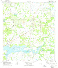
1973 Map of Parrish
USGS Topo · Published 1974About this map
Parrish serves as the central hub of this northern Manatee County landscape, situated along the Seaboard Coast Line railroad. The 1970s terrain is defined by a complex drainage network where the Manatee River meets numerous tributaries, including Gamble Creek and Mill Creek. This waterway serves as a focal point for local activity, evidenced by the Fort Hamer Boat Ramp and the Christian Retreat Campground located near Devils Elbow.
Find a feature on this map
40 named features on this map. Tap any name to fly to it.
Don’t see what you’re looking for? This feature index may not catch every label — zoom into the map to look around manually.
Map Details
Editions of this 1973 Parrish Map
3 editions found
Other maps of this area

1921 · Fort De Soto
USGS Topo · 1:62,500

1942 · Cockroach Bay
USGS Topo · 1:31,680

1944 · Ruskin
USGS Topo · 1:31,680

1944 · Rye
USGS Topo · 1:31,680

1944 · Wimauma
USGS Topo · 1:31,680

1944 · Verna
USGS Topo · 1:31,680

1944 · Lorraine
USGS Topo · 1:31,680

1944 · Ellenton
USGS Topo · 1:31,680

1944 · Parish
USGS Topo · 1:31,680

1945 · Cockroach Bay
USGS Topo · 1:31,680