
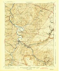
1926 Map of Parsons
USGS Topo · Published 1926About this map
The confluence of the Blackwater River and Shavers Fork forms a vital industrial corridor through this part of West Virginia in the mid-1920s. Centered on the town of Parsons, the landscape is defined by steep mountain ridges like Black Fork Mountain and Canaan Mountain that hem in narrow valleys where timber and coal towns flourished. The presence of the Western Maryland railroad facilitated heavy transit through mountain passes, connecting rail-side settlements such as Hendricks, Hambleton, and the mining hub at Coketon.
Find a feature on this map
121 named features on this map. Tap any name to fly to it.
Don’t see what you’re looking for? This feature index may not catch every label — zoom into the map to look around manually.
Map Details
Editions of this 1926 Parsons Map
2 editions found
Other maps of this area

1886 · St. George
USGS Topo · 1:125,000

1889 · Beverly
USGS Topo · 1:125,000

1891 · St. George
USGS Topo · 1:125,000

1892 · Beverly
USGS Topo · 1:125,000

1892 · Franklin
USGS Topo · 1:125,000

1895 · Piedmont
USGS Topo · 1:125,000

1896 · Franklin
USGS Topo · 1:125,000

1899 · Oakland
USGS Topo · 1:62,500

1900 · Oakland
USGS Topo · 1:62,500

1907 · Thornton
USGS Topo · 1:62,500