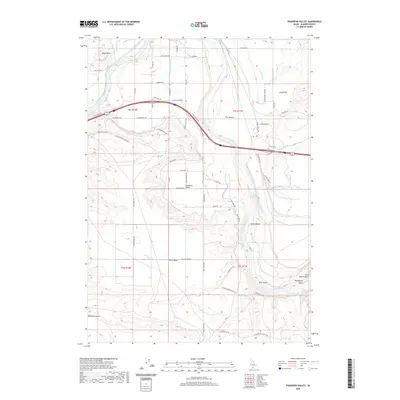
2020 Map of Pasadena Valley
USGS Topo · Published 2020About this map
Snake River canyon walls and the surrounding high desert plateaus define this region of Elmore County, where agricultural irrigation networks branch out from the river. The map illustrates a complex system of water management, including the King Hill Lateral, Basin Lateral, and Y Canal, which support the farms and ranches in Pasadena Valley and Swiss Valley. These man-made waterways contrast with the natural drainage of King Hill Cr and Deer Gulch. Large topographical features such as Black Mesa and the Sugar Bowl rise above the valley floor, while natural water sources like Bancroft Springs and Pilgrim Spring are tucked into the drainages. Evidence of human movement and land use is found in the network of local ranch roads, including Old Hwy 30 and Old Oregon Trl, which follow the natural contours of the land.
Find a feature on this map
67 named features on this map. Tap any name to fly to it.
Don’t see what you’re looking for? This feature index may not catch every label — zoom into the map to look around manually.
Map Details
Editions of this 2020 Pasadena Valley Map
This is the sole edition of this map. No revisions or reprints were ever made.
Other maps of this area

1892 · Camas Prairie
USGS Topo · 1:125,000

1893 · Camas Prairie
USGS Topo · 1:125,000

1947 · Glenns Ferry
USGS Topo · 1:24,000

1947 · Pasadena Valley
USGS Topo · 1:24,000

1948 · Pasadena Valley
USGS Topo · 1:24,000

1948 · Glenns Ferry
USGS Topo · 1:24,000

1948 · Twentymile Butte
USGS Topo · 1:24,000

1948 · Glenns Ferry
USGS Topo · 1:62,500

1948 · Ticeska
USGS Topo · 1:24,000

1948 · Grindstone Butte
USGS Topo · 1:24,000