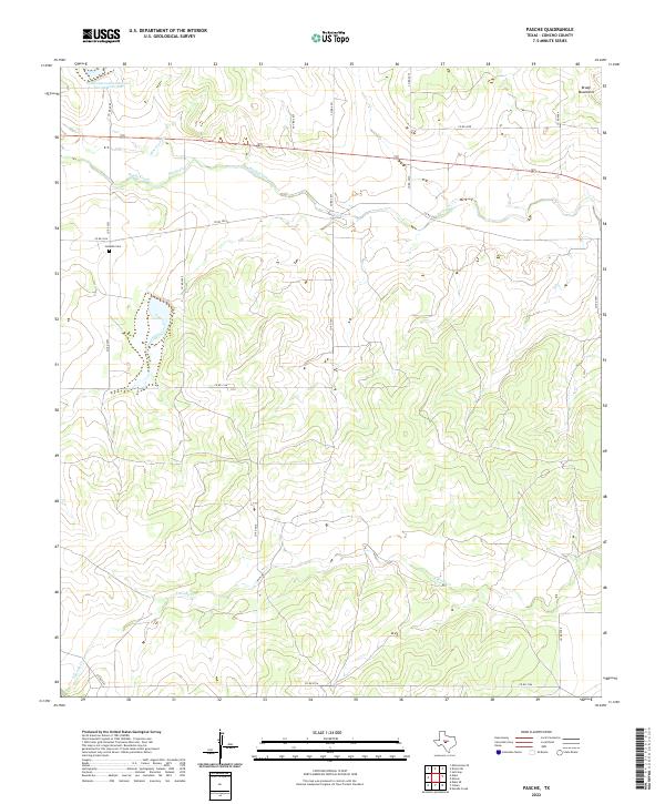
2022 Map of Pasche
USGS Topo · Published 2022About this map
Brady Mountains rise in the northeastern corner of this Concho County landscape, overlooking a drainage system dominated by the meandering course of Brady Creek. The terrain is characterized by the convergence of several waterways, including Maverick Cr and the extensive winding reach of S Brady Cr to the south. Modern water management is evident at the Soil Conservation Service Site 38 Reservoir in the northwest, part of a network of local conservation efforts. Human presence in this rural expanse is anchored by the Sudduth Cem, located just off Co RD 3053. This site provides a clear view of the ranch road network, such as Co RD 3034 and Co RD 3071, which connect the scattered agricultural holdings and family lands across the central Texas plains.
Find a feature on this map
23 named features on this map. Tap any name to fly to it.
Don’t see what you’re looking for? This feature index may not catch every label — zoom into the map to look around manually.
Map Details
Editions of this 2022 Pasche Map
This is the sole edition of this map. No revisions or reprints were ever made.
Other maps of this area

1892 · Eden
USGS Topo · 1:125,000

1896 · Eden
USGS Topo · 1:125,000

1931 · Stacy
USGS Topo · 1:62,500

1954 · Brownwood
USGS Topo · 1:250,000

1960 · Melvin
USGS Topo · 1:24,000

1967 · Millersview SE
USGS Topo · 1:24,000
1967 · Salt Gap
USGS Topo · 1:24,000
1967 · Doole SW
USGS Topo · 1:24,000

1970 · Callan
USGS Topo · 1:24,000
1970 · Needle Creek
USGS Topo · 1:24,000