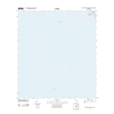
2012 Map of Pass-a-Grille Beach OE W
USGS Topo · Published 2012About this map
Treasure Island occupies the upper right corner of this coastal study, marking the barrier island landscape of Pinellas County just after the first decade of the millennium. The map is dominated by the vast expanse of the Gulf of Mexico, illustrating the relationship between the Gulf and the developed shoreline. Residential and commercial corridors are clearly defined by the local street grid, featuring Gulf Blvd as a primary artery. The layout of streets like 84th Ave and 77th Ave provides a detailed look at the island's high-density footprint. This 2012 edition serves as a precise record of the developed beachfront and shore infrastructure, highlighting the specific alignment of thoroughfares such as W Gulf Blvd and Bayshore Dr against the water's edge.
Find a feature on this map
9 named features on this map. Tap any name to fly to it.
Don’t see what you’re looking for? This feature index may not catch every label — zoom into the map to look around manually.
Map Details
Editions of this 2012 Pass-a-Grille Beach OE W Map
This is the sole edition of this map. No revisions or reprints were ever made.
Other maps of this area

1921 · Sand Key
USGS Topo · 1:62,500

1921 · Fort De Soto
USGS Topo · 1:62,500

1921 · St Petersburg
USGS Topo · 1:62,500

1943 · St Petersburg
USGS Topo · 1:31,680

1943 · Pass-A-Grille
USGS Topo · 1:31,680

1943 · Bay Pines
USGS Topo · 1:31,680

1944 · Egmont Key
USGS Topo · 1:31,680

1944 · Anna Maria
USGS Topo · 1:31,680

1947 · St Petersburg
USGS Topo · 1:25,000
1949 · Pass-A-Grille
USGS Topo · 1:25,000