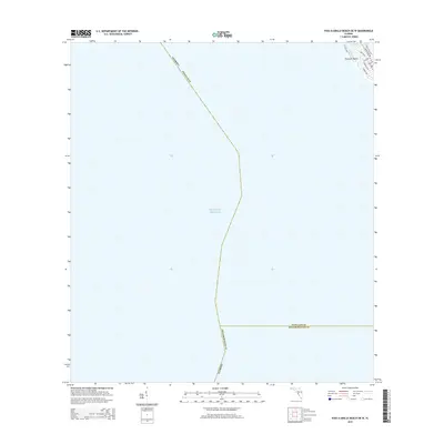
2015 Map of Pass-a-Grille Beach OE W
USGS Topo · Published 2015About this map
Gulf Of Mexico waters dominate this coastal survey, which highlights the maritime boundary between Pinellas County and Hillsborough County. The terrestrial focus is confined to the northeastern corner, where the southern tip of Treasure Island meets the sea. This area is characterized by a dense residential and commercial street grid including Boca Ciega Dr and Sunset Way, situated along the barrier island's edge. The critical passage of Blind Pass provides access between the open gulf and the Intracoastal Waterway, serving as a vital navigation point for local boaters and the coastal infrastructure. The map clearly delineates the transition from the developed beaches to the vast maritime jurisdiction of the Florida shelf in the mid-2010s.
Find a feature on this map
14 named features on this map. Tap any name to fly to it.
Don’t see what you’re looking for? This feature index may not catch every label — zoom into the map to look around manually.
Map Details
Editions of this 2015 Pass-a-Grille Beach OE W Map
This is the sole edition of this map. No revisions or reprints were ever made.
Other maps of this area

1921 · Sand Key
USGS Topo · 1:62,500

1921 · Fort De Soto
USGS Topo · 1:62,500

1921 · St Petersburg
USGS Topo · 1:62,500

1943 · St Petersburg
USGS Topo · 1:31,680

1943 · Pass-A-Grille
USGS Topo · 1:31,680

1943 · Bay Pines
USGS Topo · 1:31,680

1944 · Egmont Key
USGS Topo · 1:31,680

1944 · Anna Maria
USGS Topo · 1:31,680

1947 · St Petersburg
USGS Topo · 1:25,000
1949 · Pass-A-Grille
USGS Topo · 1:25,000