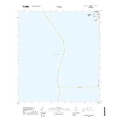
2021 Map of Pass-a-Grille Beach OE W
USGS Topo · Published 2021About this map
The coastal interface of Pinellas County is captured here along the barrier islands of the Florida Gulf Coast. Modern development lines the northern shoreline, where St. Pete Beach and Treasure Island are separated by the narrow inlet of Blind Pass. The map highlights the navigational infrastructure of the region, specifically where the Intracoastal Waterway passes behind South Pasadena. While most of the sheet covers the open waters of the Gulf of Mexico, it includes the maritime boundary between Pinellas and Hillsborough counties. For those tracking coastal changes or recreational routes, the map identifies the Florida Circumnavigational Paddling Trl as it rounds the southern tip of the peninsula, providing a contemporary record of Florida's managed shorelines and residential beach communities.
Find a feature on this map
14 named features on this map. Tap any name to fly to it.
Don’t see what you’re looking for? This feature index may not catch every label — zoom into the map to look around manually.
Map Details
Editions of this 2021 Pass-a-Grille Beach OE W Map
This is the sole edition of this map. No revisions or reprints were ever made.
Other maps of this area

1921 · Sand Key
USGS Topo · 1:62,500

1921 · Fort De Soto
USGS Topo · 1:62,500

1921 · St Petersburg
USGS Topo · 1:62,500

1943 · St Petersburg
USGS Topo · 1:31,680

1943 · Pass-A-Grille
USGS Topo · 1:31,680

1943 · Bay Pines
USGS Topo · 1:31,680

1944 · Egmont Key
USGS Topo · 1:31,680

1944 · Anna Maria
USGS Topo · 1:31,680

1947 · St Petersburg
USGS Topo · 1:25,000
1949 · Pass-A-Grille
USGS Topo · 1:25,000