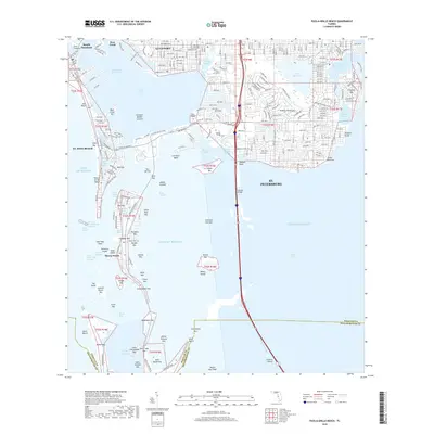
2018 Map of Pass-a-Grille Beach
USGS Topo · Published 2018About this map
Pass-a-Grille Beach and the southern barrier islands of Pinellas County are documented here as they appeared in the late 2010s. The map captures a highly developed coastal landscape where dense residential grids on Long Key and Boca Ciega Isle contrast with the numerous undeveloped keys and shoals scattered through Boca Ciega Bay. This area illustrates the complex engineering of the Florida Gulf Coast, featuring the Pinellas Bayway causeway system connecting Isla del Sol and Tierra Verde to the mainland. The inclusion of Eckerd College and the sprawling residential districts of Gulfport and St. Petersburg shows the intersection of academic, residential, and maritime life. To the south, the map details the approach to the Sunshine Skyway crossing into the Tampa Bay waters, while natural features like Cabbage Key and Shell Key Shoal highlight the shifting sands of the Gulf barrier system.
Find a feature on this map
95 named features on this map. Tap any name to fly to it.
Don’t see what you’re looking for? This feature index may not catch every label — zoom into the map to look around manually.
Map Details
Editions of this 2018 Pass-a-Grille Beach Map
This is the sole edition of this map. No revisions or reprints were ever made.
Other maps of this area

1921 · Sand Key
USGS Topo · 1:62,500

1921 · Fort De Soto
USGS Topo · 1:62,500

1921 · St Petersburg
USGS Topo · 1:62,500

1942 · Cockroach Bay
USGS Topo · 1:31,680

1943 · St Petersburg
USGS Topo · 1:31,680

1943 · Pass-A-Grille
USGS Topo · 1:31,680

1943 · Bay Pines
USGS Topo · 1:31,680

1943 · Port Tampa
USGS Topo · 1:31,680

1944 · Egmont Key
USGS Topo · 1:31,680

1944 · Anna Maria
USGS Topo · 1:31,680
Featured Places
- Saint Petersburg, FL
- Gulfport, Saint Petersburg
- Saint Pete Beach, FL
- South Pasadena, FL
- Tierra Verde, FL