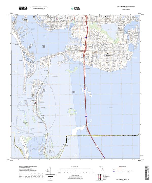
2025 Map of Pass-a-Grille Beach
USGS Topo · Published 2025About this map
South Pasadena and Gulfport border the intricate waterways of Boca Ciega Bay, where residential development meets the Florida Gulf coast's diverse aquatic landscape. This 2025 survey illustrates the high density of urban expansion in St. Petersburg, extending to the Pinellas Peninsula and the planned communities on Isla del Sol. The presence of the Saint Bartholomew Episcopal Cem offers a point of reference for genealogists, while the campus of Eckerd College marks a significant landmark on the waterfront. To the south, the map details the scattered islands and channels that lead toward Tierra Verde and the northern reaches of the Fort Desoto Park Trl, showing how the modern shoreline is defined by a network of bridges, passes, and dredging projects such as the Maximo Channel and Pass-a-Grille Channel.
Find a feature on this map
88 named features on this map. Tap any name to fly to it.
Don’t see what you’re looking for? This feature index may not catch every label — zoom into the map to look around manually.
Map Details
Editions of this 2025 Pass-a-Grille Beach Map
This is the sole edition of this map. No revisions or reprints were ever made.
Other maps of this area

1921 · Sand Key
USGS Topo · 1:62,500

1921 · Fort De Soto
USGS Topo · 1:62,500

1921 · St Petersburg
USGS Topo · 1:62,500

1942 · Cockroach Bay
USGS Topo · 1:31,680

1943 · St Petersburg
USGS Topo · 1:31,680

1943 · Pass-A-Grille
USGS Topo · 1:31,680

1943 · Bay Pines
USGS Topo · 1:31,680

1943 · Port Tampa
USGS Topo · 1:31,680

1944 · Egmont Key
USGS Topo · 1:31,680

1944 · Anna Maria
USGS Topo · 1:31,680
Featured Places
- Saint Petersburg, FL
- Gulfport, Saint Petersburg
- Saint Pete Beach, FL
- South Pasadena, FL
- Tierra Verde, FL