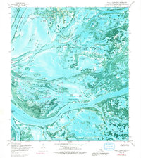
1971 Map of Pass A Loutre West
USGS Topo · Published 1991About this map
The sprawling marshlands of the Mississippi River Delta are captured here in high detail, showcasing a landscape of shifting channels and brackish ponds. This orthophotomap emphasizes the conservation and industrial dual-use of the region during the early 1970s, where the Delta National Wildlife Refuge and Pass A Loutre State Waterfowl Management Area coexist with the Delta Duck Oil Field. The complex hydrological network includes significant landmarks like the Head of Passes, the critical junction where the river divides into its major distributaries. Named water bodies such as Brant Bayou and Pailleen Queue Pond reveal the local nomenclature of the Louisiana wetlands. Numerous small landmasses like Goose Island and Japan Island emerge from the water, while family-named features like Joe Brown Pond and Joe Dennis Pond suggest the long-standing human presence of trappers, fishers, and hunters in Plaquemines Parish.
Find a feature on this map
73 named features on this map. Tap any name to fly to it.
Don’t see what you’re looking for? This feature index may not catch every label — zoom into the map to look around manually.
Map Details
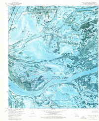
Editions of this 1971 Pass A Loutre West Map
2 editions found
Other maps of this area

1893 · East Delta
USGS Topo · 1:62,500

1893 · Forts
USGS Topo · 1:62,500

1893 · West Delta
USGS Topo · 1:62,500

1935 · Garden Island Pass
USGS Topo · 1:31,680

1935 · South Pass
USGS Topo · 1:31,680

1947 · Garden Island Pass
USGS Topo · 1:31,680

1947 · Pass A Loutre West
USGS Topo · 1:31,680

1947 · Venice
USGS Topo · 1:31,680

1947 · Southwest Pass
USGS Topo · 1:31,680

1947 · Main Pass
USGS Topo · 1:31,680