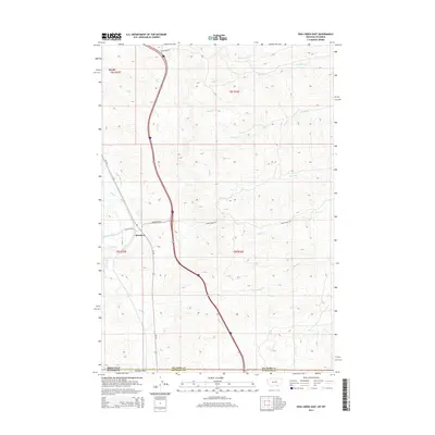
2014 Map of Pass Creek East
USGS Topo · Published 2014About this map
Wyola and Aberdeen anchor this landscape along the border of Montana and Wyoming, where the drainage systems of the Bighorn Mountains meet the high plains. The terrain is defined by an intricate network of waterways, including Wyola Cr and Pass Cr, which are supplemented by human engineering projects like the Upper Spear Ditch and Thompson Ditch. These irrigation features speak to the region's agricultural dependency in an arid environment. The map details a transition from the drainage basins of Big Pine Cr and Wolf Cr in the north to Owl Cr and Line Rider Cr as the land slopes south toward the state line. This 2014 survey documents the persistence of small rural settlements and the vital water infrastructure necessary for life in the Big Horn County and Sheridan County borderlands.
Find a feature on this map
25 named features on this map. Tap any name to fly to it.
Don’t see what you’re looking for? This feature index may not catch every label — zoom into the map to look around manually.
Map Details
Editions of this 2014 Pass Creek East Map
This is the sole edition of this map. No revisions or reprints were ever made.
Other maps of this area

1894 · Rosebud
USGS Topo · 1:125,000

1895 · Dayton
USGS Topo · 1:125,000

1901 · Rosebud
USGS Topo · 1:125,000

1901 · Dayton
USGS Topo · 1:125,000

1954 · Hardin
USGS Topo · 1:250,000

1955 · Sheridan
USGS Topo · 1:250,000

1957 · Hardin
USGS Topo · 1:250,000

1958 · Hardin
USGS Topo · 1:250,000

1958 · Sheridan
USGS Topo · 1:250,000

1962 · Sheridan
USGS Topo · 1:250,000