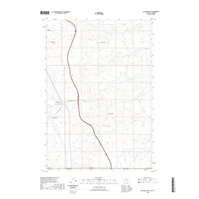
2020 Map of Pass Creek East
USGS Topo · Published 2020About this map
Aberdeen and Wyola anchor this Montana-Wyoming border landscape, where the high plains meet the intricate drainage systems of the Big Horn County region. The map reveals a complex water management history through features like the Upper Spear Ditch and Thompson Ditch, which parallel the course of Pass Cr to support local ranching or agriculture. These man-made channels snake through the terrain alongside natural waterways such as Wyola Cr and Wolf Cr. The state line between Montana and Wyoming bisects the lower portion of the sheet, crossing Gannon Draw and marking the boundary between Big Horn County and Sheridan County. This network of creeks—including Line Rider Cr and Middle Pine Cr—illustrates the vital role of water rights and geographic borders in defining this rural frontier territory.
Find a feature on this map
27 named features on this map. Tap any name to fly to it.
Don’t see what you’re looking for? This feature index may not catch every label — zoom into the map to look around manually.
Map Details
Editions of this 2020 Pass Creek East Map
This is the sole edition of this map. No revisions or reprints were ever made.
Other maps of this area

1894 · Rosebud
USGS Topo · 1:125,000

1895 · Dayton
USGS Topo · 1:125,000

1901 · Rosebud
USGS Topo · 1:125,000

1901 · Dayton
USGS Topo · 1:125,000

1954 · Hardin
USGS Topo · 1:250,000

1955 · Sheridan
USGS Topo · 1:250,000

1957 · Hardin
USGS Topo · 1:250,000

1958 · Hardin
USGS Topo · 1:250,000

1958 · Sheridan
USGS Topo · 1:250,000

1962 · Sheridan
USGS Topo · 1:250,000