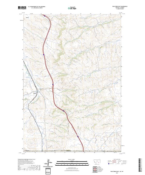
2024 Map of Pass Creek East
USGS Topo · Published 2024About this map
Wyola and Aberdeen anchor this modern topographical study of the Big Horn County landscape, where the Montana-Wyoming border intersects a complex network of high-plains water management. The terrain is defined by the drainage of Pass Creek and its many tributaries, including Wolf Creek, Sheep Creek, and Owl Creek. This environment is heavily influenced by agricultural water infrastructure, most notably the Upper Spear Ditch and Thompson Ditch, which trace the contours of the valley floors to support ranching and farming operations.
Find a feature on this map
25 named features on this map. Tap any name to fly to it.
Don’t see what you’re looking for? This feature index may not catch every label — zoom into the map to look around manually.
Map Details
Editions of this 2024 Pass Creek East Map
This is the sole edition of this map. No revisions or reprints were ever made.
Other maps of this area

1894 · Rosebud
USGS Topo · 1:125,000

1895 · Dayton
USGS Topo · 1:125,000

1901 · Rosebud
USGS Topo · 1:125,000

1901 · Dayton
USGS Topo · 1:125,000

1954 · Hardin
USGS Topo · 1:250,000

1955 · Sheridan
USGS Topo · 1:250,000

1957 · Hardin
USGS Topo · 1:250,000

1958 · Hardin
USGS Topo · 1:250,000

1958 · Sheridan
USGS Topo · 1:250,000

1962 · Sheridan
USGS Topo · 1:250,000